- Remembering Professor Chris Williams
- Current Undergraduate Students
- Graduate Studies
- Future Students
- International Students
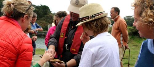
- Research
- CACSSS Research Areas
- Research Impact
- A Socio-Economic Study of Cork City Northwest Quarter Regeneration (CNWQR)
- Children’s Voices in Housing Estate Regeneration
- Cork Folklore Project
- Deep Maps: West Cork Costal Cultures
- Developing research to deliver high impacts in homelessness service provision by Cork Simon
- Moving On Ireland
- Project DaRT - Discussions and Reflections on Translation
- The Cork Folklore Project’s Memory Map
- The World-Tree Project
- The Augustinian Friars in Late Medieval Ireland
- (Re)Sounding Holy Wells
- Atlas of the Irish Revolution
- False Memories for Fake News in the Irish Abortion Referendum
- Atlas of the Great Irish Famine 1845-1852
- Hidden Galleries
- Movie Memories
- Between Two Unions: The constitutional future of the islands after Brexit
- Spotlight
- Speaking the Predicament: Empowering Reflection and Dialogue on Ecological Crisis
- Participatory arts for advocacy, activism and transformational justice with young people living in Direct Provision
- Make Film History Wins FIAT/IFTA Archive Achievement Award
- Dr. Marie Kelly (School of Film, Music & Theatre) co-edits : Scene 8 Volumes 1 and 2 (2021) – Special Issue: ‘Performance and Ireland’ (Intellect)
- The significance of humanities scholarship in challenging times
- Dr Sarah Foley, a Lecturer in the School of Applied Psychology, was awarded an NUI Grant for Early Career Academics in 2020
- NUI Awards Grant for #DouglassWeek: 8th-14th February, 2021
- Humanities for the Anthropocene
- Forgotten Lord Mayor: Donal Óg O’Callaghan, 1920-1924
- Architectural Space and the Imagination: Houses in Literature and Art from Classical to Contemporary
- Dr Siobhan O’Sullivan - Agency and ageing in place in rural Ireland
- Launch of new research cluster on 'Life Writing'
- What keeps us going?
- Through the lens of the secret police: Images from the religious underground in Eastern Europe
- Dr. Amanullah De Sondy - The Pocket Facts Guide for Jewish, Christian and Muslim People 2020
- Issue 19 of Alphaville published by The Department of Film and Screen Media
- Digital Edgeworth Network
- Make Film History: Opening up the Archives to Young Filmmakers
- Establishment of monthly online reading group on Abolition and Decarceration
- Dr Anne Marie Devlin (Applied Linguistics) published a special issue on Study abroad and the Erasmus+ programme in Europe
- Dr. Barbara Siller (Department of German), has co-published an edition on literary multilingualism.
- Postgraduate Researchers from MA in Medieval History produce Mapping Cork online exhibition
- Adaptation Considered as a Collaborative Art: Process and Practice, (Eds.: Bernadette Cronin, Rachel MagShamhráin and Nikolai Preuschoff
- (Non)Spectacular Infrastructure: Enacting Resource Circulation in Stages, Studios and Communities
- Dr. Clíona O’Carroll (Department of Folklore) has received an IRC New Foundations grant
- Dr Catherine Forde from the School of Applied Social Studies has been awarded an IRC New Foundations grant
- Elderly (non)migrants’ narratives of home: A comparative study of place-making in Ireland and Slovakia (EMNaH)
- Dr. Ken Ó Donnchú, lecturer in the Department of Modern Irish, has received an IRC New Foundations Award
- Decolonizing Irish Public Heritage
- EMBRACE - Exploring Mobility: Borders Refugees and Challenging Exclusion
- Dr. Marica Cassarino (School of Applied Psychology) awarded Royal Irish Academy and British Academy Knowledge Frontiers Network Funding
- CACSSS Postdoc wins Charlemont Grant
- Childhood, Religion and School Injustice by Karl Kitching
- New Collaboration between UCC, RTÉ and the Department of Culture, Heritage and the Gaeltacht
- Cork Movie Memories - Dan O’Connell and Gwenda Young (Department of Film and Screen Media
- Chronicles of COVID-19/Cuntais COVID-19’ initiative: testimony collection by Cork Folklore Project
- Dr. Rachel MagShamhrain (Head of Department of German) has published a co-edited collection on Adaptation
- Professor Caitríona Ní Dhúill (Department of German) has published a new monograph
- Two School Postdoctoral Fellows Awarded Royal Irish Academy and British Academy Funding
- Funding Success for Dr Joanna Hofer-Robinson
- New Collaboration between UCC, RTÉ and the Department of Culture, Heritage and the Gaeltacht
- CACSSS Postdoc wins Charlemont Grant
- Applied Social Studies team win ESWRA Outstanding Publication Award 2020
- CACSSS postdoc is awarded Maurice J. Bric Medal of Excellence at IRC’s Researcher of the Year Awards 2019.
- Past postdoctoral researchers in the College
- Dr Mastoureh Fathi
- Dr Michalis Poupazis
- Dr Richard Mason
- Dr Martin Wall
- Dr Rebekah Brennan
- Dr Tatiana Vagramenko
- Dr Anca Maria Șincan
- Dr Agnes Hesz
- Dr Gabriela Nicolescu
- Dr Kinga Povedák
- Dr Declan Taggart
- Dr Anne-Julie Lafaye
- Dr Ken Keating
- Dr Laura Maye
- Dr Martina Piperno
- Dr Brandon Yen
- Dr Annie Cummins
- Dr Rebecca Boyd
- Dr Sean Hewitt
- University Staff Recognition Awards
- CACSSS Welcome new MSCA Funded Fellows
- College of Arts, Celtic Studies and Social Sciences opens a research facility on Wandesford Quay
- IMMERSE
- CACSSS Wins Big at UCC 2018 University Staff Recognition Awards
- Upcoming Events
- Event Archive
- CACSSS Research Highlights 2012 - 2020
- Research News Archive
- IRC awards funding to 3 projects in the Dept of Archaeology: DAEICS - Digital Atlas of Early Irish Carved Stones (PI Dr Tomas O’Carragain)
- IRC awards funding to 3 projects in the Dept of Archaeology: NEW PASTURES (PI Dr Katharina Becker)
- CIPHER project shortlisted for Times Higher Ed (THE) Award
- CACSSS Researcher funded through HEA North South Research Programme with UU to explore Critical Epistemologies Across Borders (CEAB)
- Leabhar Nua ar an bhFiannaíocht/New Publication on the Finn Cycle
- Cork and Belfast north south prison-university classroom partnerships secure funding from government’s shared island initiative
- Women of the Borderlands: A Walking Biographical Study of Women’s Everyday Life on the UK/Irish Border funded through the HEA North-South Partnership
- Ultonia - Cultural Dynamics in medieval Ulster and beyond: a shared inheritance
- IRC awards funding to 3 projects in the Dept of Archaeology: IPeAT - Irish Peatland Archaeology Across Time (PI Dr Ben Gearey)
- Dr Edward Molloy, School of English and DH - wins Maurice J. Bric Medal of Excellence in IRC’s Researcher of the Year Awards 2020.
- Professor Claire Connolly (School of English and Digital Humanities) appointed to the Irish Research Council
- Dr Máirín MacCarron FRHistS wins the NUI Irish Historical Research Prize 2021
- ERC Hidden Galleries project publishes The Secret Police and the Religious Underground in Communist and Post-Communist Eastern Europe
- CACSSS researchers to host EPA funded online workshop
- €1.5 million ERC Starter Grant Award for Researcher in Dept of Music, School of Film Music and Theatre
- Three PhD students in Applied Psychology commence projects funded through SFI research centre Lero
- CACSSS Researcher co-authors paper for Science on the ‘ecological’ survival of rare manuscripts and texts
- 2021 Research Awardees recognised
- New Foundations Call 2022 open
- C21 Editions
- University College Cork and the Arts Council have appointed Alan Gilsenan as the 2019/20 Film Artist in Residence.
- School of Applied Psychology hold an open house showcase for People and Technology Research Group
- CACSSS Researcher secures major IRC Laureate award for project GENCHRON to explore gender, chronology and time in the Medieval world
- CACSSS Researcher secures major IRC Laureate award for project Cyber Social
- New York Times reports on CACSSS Researcher Dr Alexander Khalil’s (School of Film, Music & Theatre) collaborative music and neuroscience work
- project MUSLIMWOMENFILM project selected for publication in the ‘Results in Brief’ section of the European Commission’s CORDIS website
- GendeResearchIreland Symposium: Reflections on Institutionalising Gender Equality in Higher Education
- Community Engagement
- Careers & Employability
- Information for Guidance Counsellors
- Information for Staff
- Schools in the College
- People
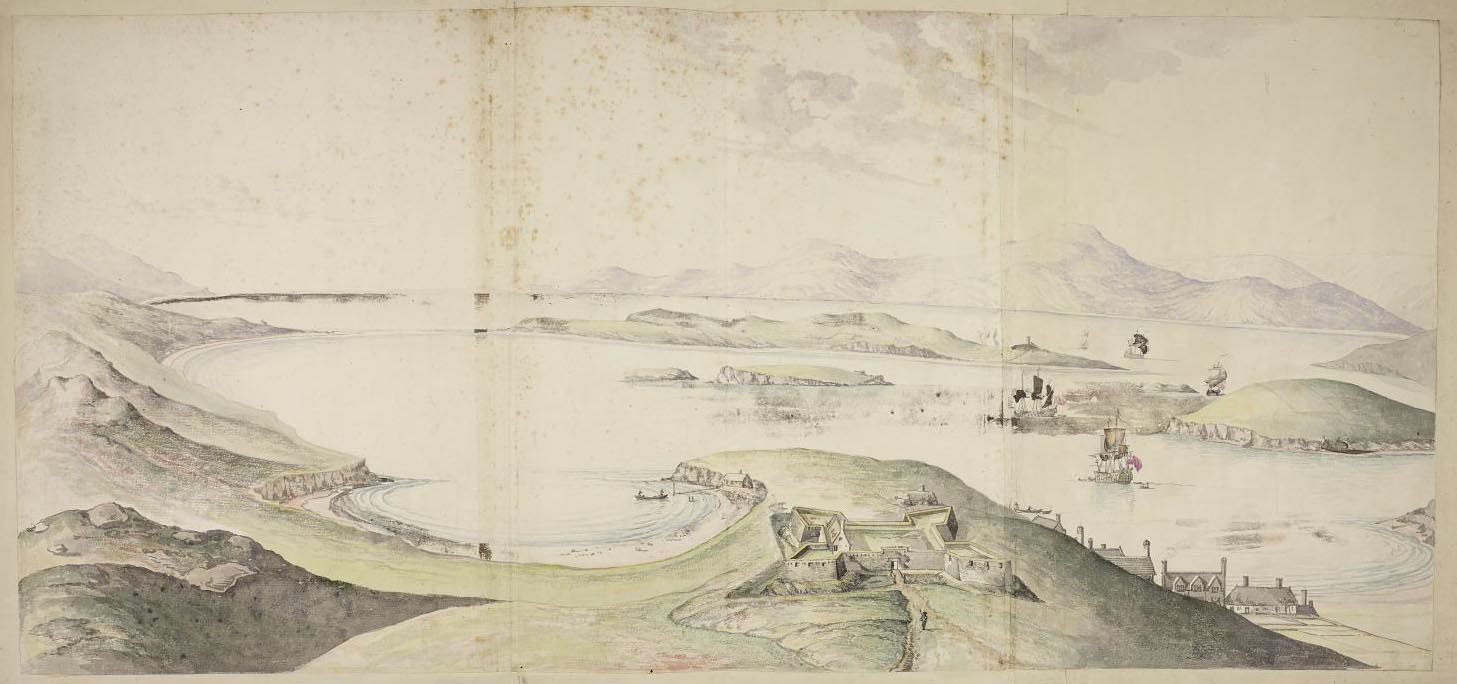
Deep Maps: West Cork Costal Cultures
The Challenge
Connecting cultural history and marine biological research, Deep Maps fosters ongoing stewardship of Cork’s coast and Ireland’s maritime heritage. The project visualises the coastline in innovative ways and offers a comprehensive approach to understanding place. Deep Maps engages community stakeholders to identify environmental priorities and share their knowledge. Past and present are interwoven as literature, history, science and culture provide new ways of thinking about our endangered marine environment. The project maps the cultural history of the coastline in order to communicate a deeper knowledge of places, history, people and stories.
The Research
Both intensive and extensive, Deep Maps investigates the biological, cultural and historical contexts of the south west coast of Ireland from 1700 to 1920, exploring the maritime environment found along the arc of Cork’s Roaring Water Bay, from Clonakilty to Bantry Bay. In bringing literary traditions together with environmental sciences and digital technologies, Deep Maps demonstrates how coastal sites are reservoirs of personal, cultural and biological data. Knowledge flows from and to community stakeholders, with the goal of increasing public awareness of the rich but intangible heritage of the region. This innovative model of mapping results in layered storytelling that effectively expresses complex accounts of space and time. As such, Deep Maps departs from literal cartography to bring history, culture and biology together in original visualisations that can be accessed digitally.
“By connecting specialised scientific understandings of the marine environment with the stories, ideas and feelings associated with our coasts, we can help to create a new future for our seas.”
– Professor Claire Connolly, Principal Investigator
The Impact
Deep Maps responds to needs emerging from both humanities and STEM research: in the case of the former, the environmental humanities have posed urgent questions about the scope and scale of human interactions with the environment as represented in literature and other texts; while in the case of marine biology, scientists are increasingly aware of the need to deepen and enrich their understanding of coastal environments via a more nuanced sense of the histories and cultures of these storied places. This transdisciplinary approach draws upon:
A scientific literature review;
- Workshops with community stakeholders;
- Sketches, photographs, poems, newspapers, letters and other historical artefacts; and
- Collection and analysis of Geographic Information Systems (GIS) data.
The project uses digital media to visualise and connect different kinds of knowledge about the coastline, and establishes dialogue with diverse audiences. This includes:
- A weekly blog series which has reached audiences in Ireland, the United Kingdom, the United States, China, Russia, Canada, Germany, France and Italy
- Integrated social media campaigns via Facebook, Twitter, Storify and Instagram;
- An open access Deep Maps website, incorporating interactive story maps, timelines and apps; and
An exhibition within the Glucksman Gallery on the UCC campus, from August to November 2017, which garners public feedback by taking visitors on a journey from traditional cartography through objects of cultural value and scientific inquiry.
One of the risks associated with any digital project is the rapidly-changing digital environment. With longevity in mind, the Deep Maps team worked with UCC Library’s
Research and Digital Services to develop a records management strategy that draws upon best practice guidelines from the Digital Repository of Ireland. Deep Maps assets are provided in preservation-friendly formats so that the research remains readily accessible.
Other engagement includes:
- Artwork, storytelling and surveys with primary school students and teachers at Coomhola National School, Bantry; Rath National School, Baltimore; and the Educate Together National School, Cork City;
- Academic presentations in Dingle, Co. Kerry; Cardiff, Wales; Sesimbra, Portugal; South Bend, Indiana, United States; Cork City, Co. Cork; and other locations;
- New collaborations with Skibbereen Heritage Centre; West Cork College; St Peter’s Church; Cork Nature Network; and others;
Deep Maps develops and uses novel transdisciplinary research techniques that bridge arts, humanities, science and technology. The project relies on the exchange of public tacit knowledge and resources through ongoing engagement, public events and open access repositories. It has stimulated public discourse on biodiversity, conservation, climate change, fisheries, aquaculture, pollution, policy and legislation. Deep Maps has attracted funding to support five research assistants and one postdoctoral researcher, impacting Ireland’s research ecosystem.
For More Information
This project is funded by the Irish Research Council New Horizons Award and is led by Professor Claire Connolly (School of English) and Dr Rob McAllen (School of Biological, Earth and Environmental Sciences). See: http://www.deepmapscork.ie.