- Home
- Semester and Timetable Information
- Study Physics
- Our Research
- Our People
- Careers and Alumni
- Seminars, News and Events
- Outreach and School Resources
- About the School
- What is Physics
- The Crawford Observatory
- Frequently Asked Questions
- UCC Futures Quantum & Photonics
- Supports
News
The Gravity of the Situation in the Crawford Observatory
Last week an international project which has been ongoing for 2 years has seen the UCC Campus recognised as part of a global network - The International Gravity Station Network (IGSN).
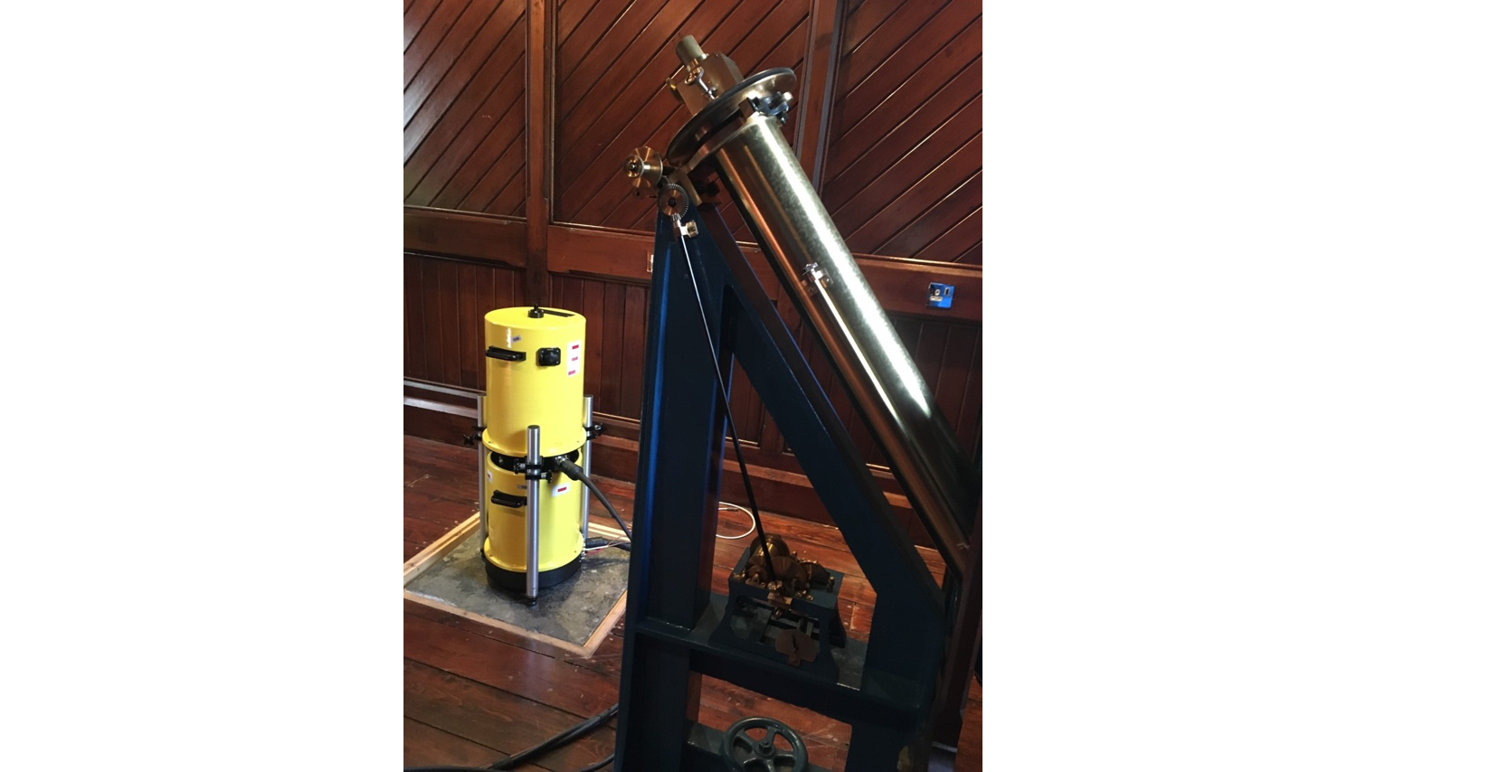
A particular patch of ground on the campus, measuring less than one square metre, and located in the Crawford Observatory, is one of the most important places in Ireland to measure the Earth’s force of gravity. Gravity measurements have been taking place in the Observatory for at least 50 years: these absolute measurements have been made from a location fixed to the very stable foundations of the Observatory, and hence are extremely reliable
Modern devices can measure the Earths gravity to precision of a few parts in a billion, a thousand times more accurately than possible 50 years ago. At this level of accuracy, the gravity of the Earth we experience can be significantly affected by several natural phenomena including the ocean tides and even the weather! But why make sure precise measurements of the Earths gravity ?
First and foremost, the members of the IGSN are monitoring the shape of the Earth, known as the “Geoid”. The shape of the Earth undergoes daily changes as well as long term changes (seasonal, annual and over centuries). These measurements can be combined with satellite measurements, which cover a larger areas, but to much lesser accuracy. Measuring the Earth’s gravity from space has given us important about melting ice and corresponding sea level increases, for example.
Also, Geophysicists regularly use ground based gravimeters to locate density anomalies beneath the surface, such as buried valleys or mineral resources and as well as assisting in engineering projects. These gravimeters measure gravity relative to an absolute base station, and the measurements from the Crawford Observatory greatly assist these. Indeed, the crew of several survey ships, for example, have visited the Observatory in the past to calibrate their instruments before embarking on voyages exploring adjacent ocean basins.
In addition, local measurements of gravity can tell us if our land surface is rising or falling over time. For example, past measurements have shown that the land surface (coastline) of county Cork and Waterford are slowly subsiding, at a rate ~ 0.5 mm per year (curiously, the Northern parts of the country are rising, as the island slowly tilts about an East-West axis). It will be possible to monitor this more accurately in the future, because of the measurements made in the Crawford Observatory. This is important, for example, because the global sea level rise is compounded by land subsidence and we must add these two values together to get a proper estimate of our local sea-level rise, and its likely impact, for example, on the South Coast of Ireland.
Dr Bettie Higgs, Geology, UCC
Prof Paul Callanan, Department of Physics, UCC