Geological mapping of the North-Western Irish Sea - Update from the I-MORE project
Guillaume writes some updates about the I-MORE project progress and upcoming associated research.
Geological Model
A new milestone has been reached in the I-MORE project[1]! During the last few months[2], the scientific team (Dr. Guillaume Michel, Dr. Mark Coughlan and Prof. Andrew Wheeler) has been defining a geological model in the North-Western Irish Sea. Several horizons have been mapped from muddy quaternary sediments to till and basement by exploring seismic datasets sourced from academic surveys and the INFOMAR program.
This geological model is the first step towards producing a ground model. However, to do so, additional ground-truthing data are required. As one objective of the I-MORE, target sites to be surveyed have been identified.
Also, geological features such as scours or tunnel valleys have been evidenced during the interpretation of the seismic data. These features act as great markers of the different episodes of glaciation and deglaciation. A new study will be conducted on these features in the upcoming weeks and results will be presented at EGU22 General Assembly in May.
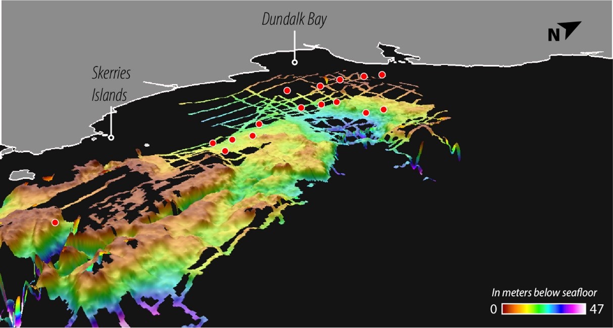
Figure 1: 3D map of the quaternary sediment base in the North-Western Irish Sea, in meters below the seafloor, with the location of already axquired CPT data as red dots[3]. CPT data interpretation has already been published by Coughlan et al. (2019)[4].
I-MORE Survey
In January, a 10 days survey on the R/V Celtic Explorer [1] allowed the acquisition of geotechnical data at the location of selected target sites. This survey was funded by the Sustainable Energy Authority of Ireland (SEAI) and led by Gavin & Doherty Geosolutions (GDG) with equipment from Marine Sampling Holland. During this survey, conducted by Mark Coughlan, Guillaume Michel was involved in operation planification. He was also involved in equipment positioning oversee with the use of Ultra-short baseline (USBL) beacon systems, collaborating with electronic technicians from the Marine Institute.
High-quality Cone Penetration Test (CPT) data have been acquired in several locations, cumulating a few hundred meters of geotechnical profiles. This data located along the seismic lines will be QA/QC by GDG and then integrated into the geological model to produce the ground model.
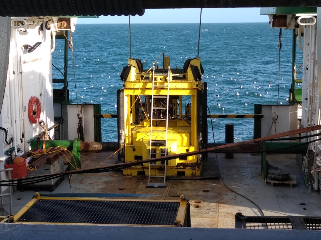
Figure 2: Picture of the Manta CPT system from Marine Holland Sampling on the deck of the R/V Celtic Explorer (Credit: Guillaume Michel). You may notice the impatience of the seabirds audience waiting for some action!
What comes next?
Some time will be spent exploring Machine Learning (ML) techniques. The objective is to use ML to build the ground model by combining CPT and seismic data. These techniques have already been used by other studies but should be tuned to match the datasets and objectives of the I-MORE project.
Who knows, maybe the topic of the next article on the I-MORE project?
[1] https://www.ucc.ie/en/marinegeology/projects/oceanresources/imore/
[2] https://www.ucc.ie/en/marinegeology/news/the-irish-sea-yet-to-unveil-all-its-secrets.html
[3] https://www.ucc.ie/en/media/research/marinegeo/mgpdfs/GOST_Cruise-report_final.pdf
[4] Coughlan, M., Wheeler, A. J., Dorschel, B., Long, M., Doherty, P., & Mörz, T. (2019). Stratigraphic model of the Quaternary sediments of the Western Irish Sea Mud Belt from core, geotechnical and acoustic data. Geo-Marine Letters. https://doi.org/10.1007/s00367-019-00569-z
Marine Geosciences Research Group
University College Cork
Contact us
School of Biological, Earth and Environmental Sciences, North Mall Campus, University College Cork, North Mall, Cork City, T23 TK30