Cold water corals in 3D – Updates from Larissa
If you have ever wondered how the Irish seabed looks like at 700 metres depth, this post is for you!
PhD candidate Larissa Oliveira has been working on video data acquired with the ROV Holland 1 to produce 3D models of the cold-water coral (CWC) reefs. Larissa uses underwater photogrammetry to reconstruct the seafloor from images extracted from the HD video data of the ROV. To do that, she uses a technique called Structure-from-Motion (SfM) to create a variety of models from different Marine Protect Areas in the Irish Sea, such as the Porcupine Bank Canyon and the Belgica Mound Province. In SfM, the 3D scene is reconstructed from a sequence of 2D images extracted from the video by detecting common feature points, see example below:
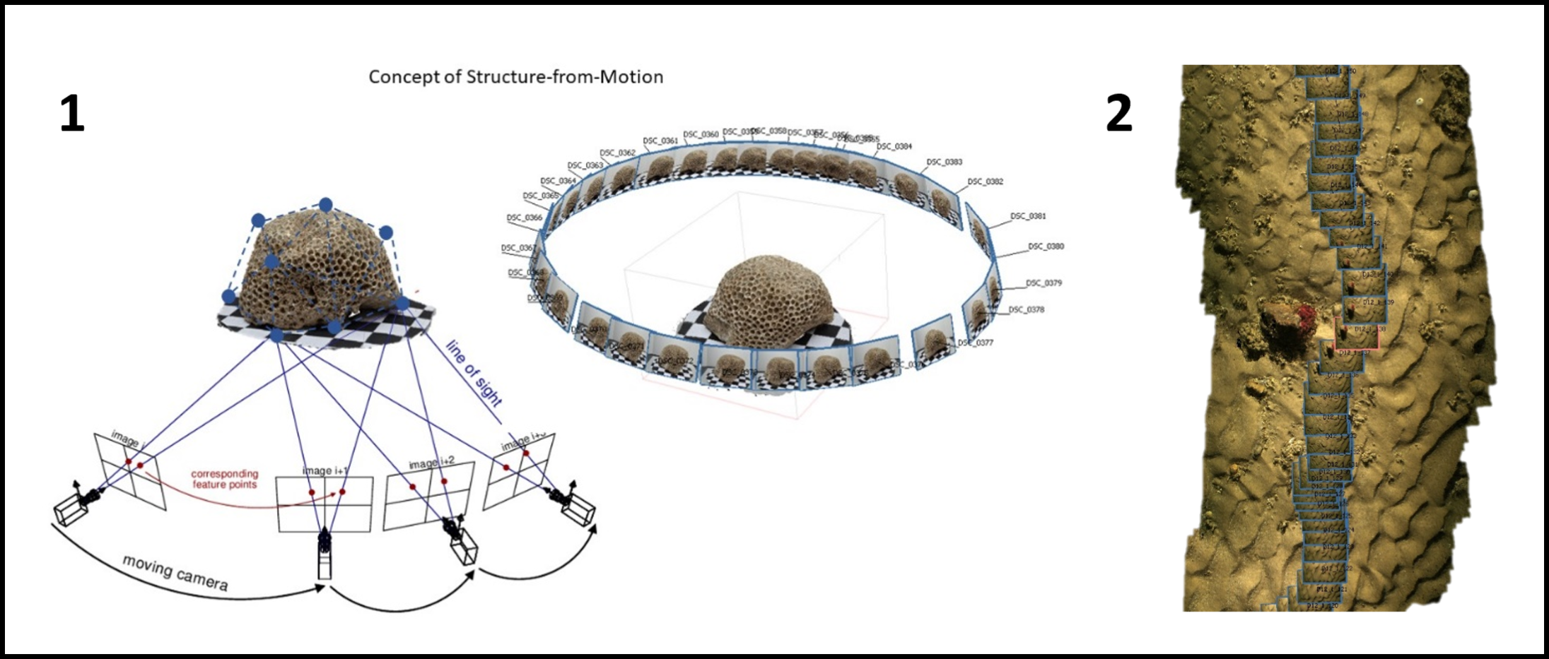
1. Adapted from: Riel, S. Van. (2016). Exploring the use of 3D GIS as an analytical tool in archaeological excavation practice. June. https://doi.org/10.13140/RG.2.1.4738.2643. 2: 3D model by Larissa
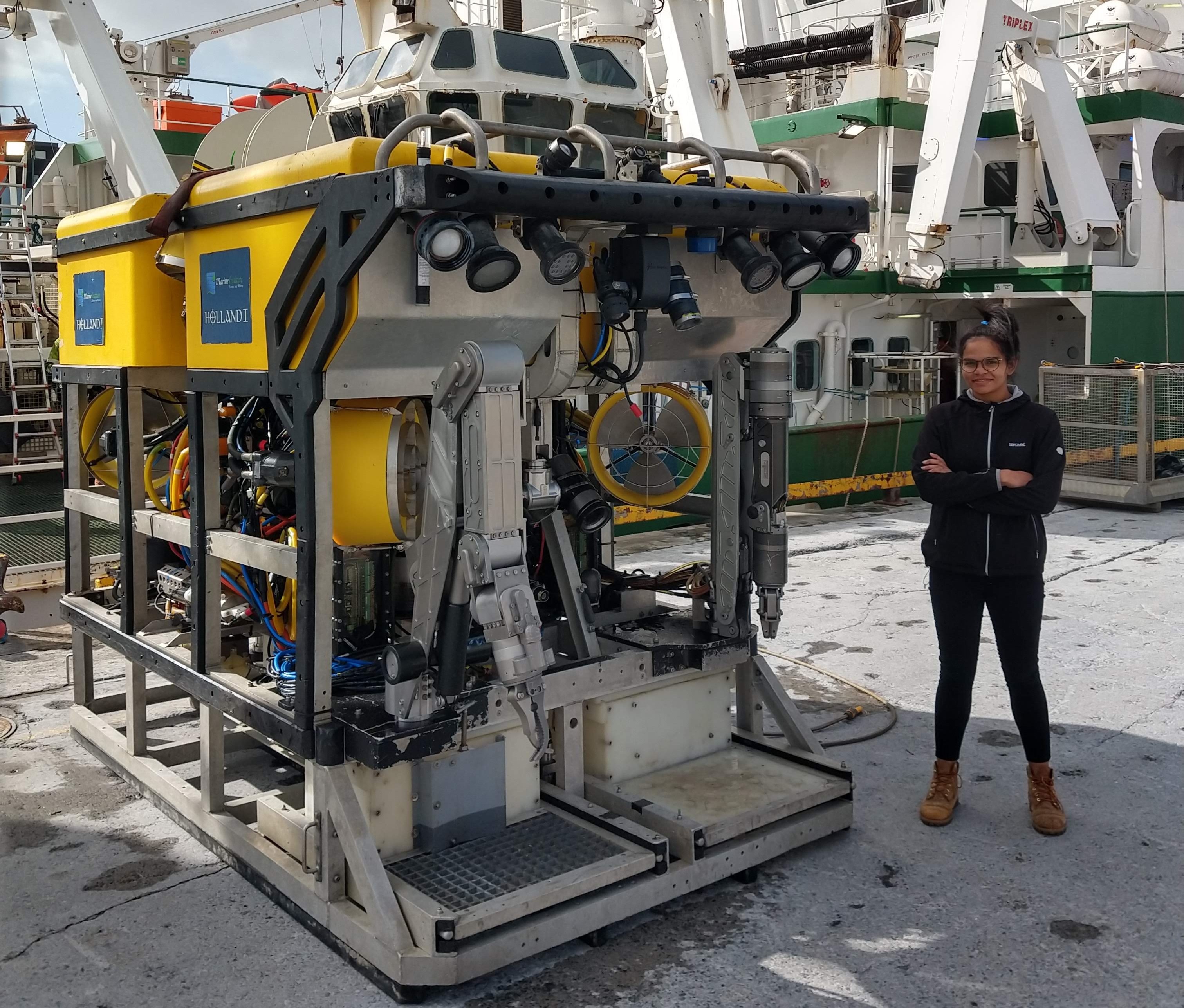
To collect the data, UCC Marine Geosciences Research group carried out several research expeditions using the ROV Holland 1 onboard of the Celtic Explorer. This state-of-the-art scientific aparatus is one of the many pieces of equipment owned by the Marine Institute (MI). The Holland 1 is deployed at the locations of interest for our research, where we aim to analyse CWC environmental conditions a bit further. Whilst our average deployment depth is around 1000 m, ROV itself can go as deep as 3000 metres!
After we acquire the video data, it is time to go back onshore and start the reconstruction process. The video needs to be analysed first to remove the low-quality parts e.g. when the visibility is too low. Then we extract the frames from the video at a specific rate per second, depending on the quality of the video and the level of detail we aim to reach. We then use a 3D photogrammetry software to reconstruct and georeference the model so we know exactly where the 3D model is located in real word.
Larissa uses these 3D models for a range of experiments on her PhD project ASMaT. In her latest research, she analysed different techniques to develop a workflow for high-resolution CWC classification using photogrammetry data. To know more about Larissa’s project, check out the project page and stay tuned for more 3D updates!
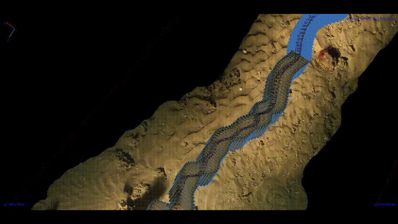
View from 3D model with the camera track. This is how the seabed looks like at approx. 968 m depth around Piddinton Mound in the Belgica Mound Province.
Marine Geosciences Research Group
University College Cork
Contact us
School of Biological, Earth and Environmental Sciences, North Mall Campus, University College Cork, North Mall, Cork City, T23 TK30