Creating an event and ground truth geodatabase:
Information and statistics regarding wildfire events in Ireland are scarce. The limitations of reported fire data include incompleteness, inconsistency in reporting of extent and nature of burn, and a lack of timeliness. However, the reliability of existing satellite and ground datasets need to be evaluated and ground truth data are precious as a validation source when designing new methodologies.
In order to create an event and ground truth geodatabase of wildfires in Ireland from 2015 to 2021 several sources have been explored:
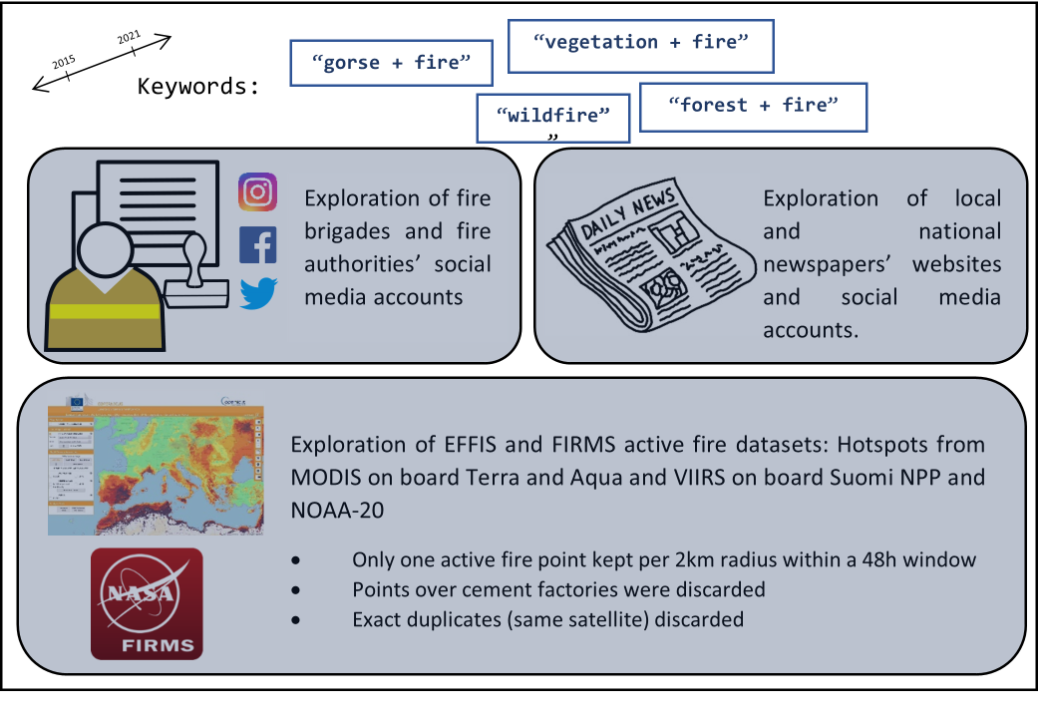
Here are the first statistics in terms of evaluating the number of fires happening in Ireland every year:
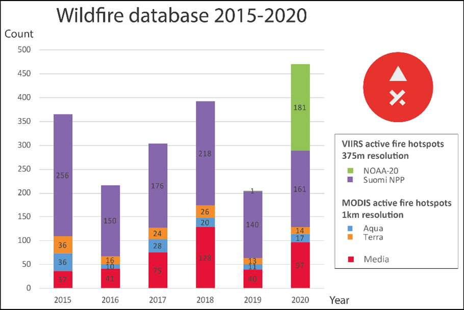
However, some biases have been identified in this database:
- Possible duplicates: Different satellites may have reported the same event. Media fire events may have been reported by satellites as well.
- Introduction of NOAA-20 only in late 2019
- Bias toward Cork and Dublin areas (Dublin, Cork and Bantry brigades are really active on social medias)
- Unprecise geocoding of locations found in media reports.
These biases have been taken into account while analysing the dataset for temporal and spatial patterns.
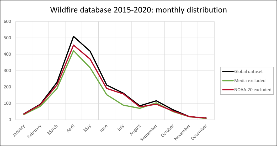
- 2020 is the year with most fires only because of the addition of NOAA-20.
- 2018 appears as an exceptional year.
- The addition of NOAA-20 reports doesn’t change the global yearly pattern but we can notice that media reports tend to increase the high season effect from April to August.
- April and May are clearly the months for which the numbers of fire reports are the highest.
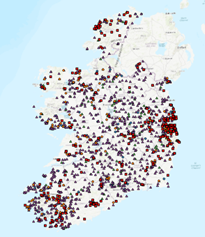
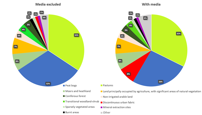
When looking at the landcover (CORINE landcover 2018) on which fires are happening, the addition of media reports shows a bias towards urban areas (“Discontinuous fabric”). It can also be linked with the approximate geo-localisation of these fires. A third of fires are happening on the “Pastures” land cover but pastures represent 51% of Ireland’s total CORINE landcover. The distribution of fire landcovers is not that different from the total distribution in Ireland. Peat bogs as well as Moors and heathland are the only two landcovers which are overrepresented when looking at fire reports.
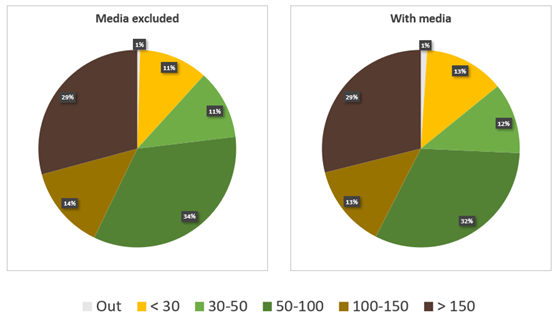
The repartition of fire events regarding their elevation does not change with the addition of media reports. If upland areas over 150m represent a great part of fires, most fires still happen below 150m.
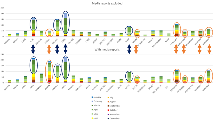
At a county level, Dublin and Cork numbers rise, and the weight of 2018 increases with the addition of media reports. That year was a year of raising awareness regarding wildfires issues.
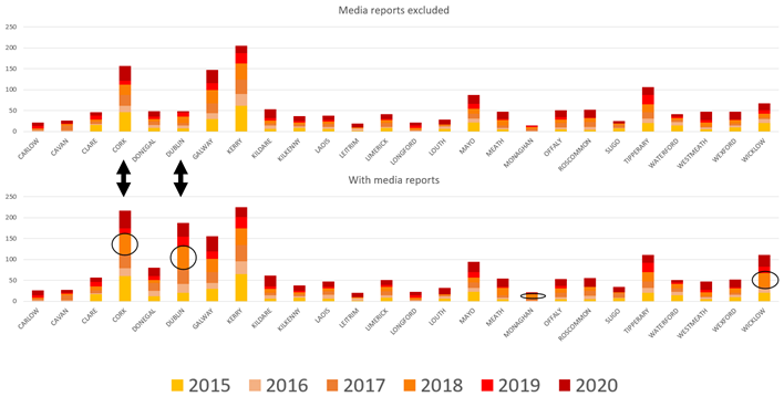
Looking at the distribution of fire reports per county and per month, we notice once again the prevalence of fires in March, April, and May. The West of Ireland (Cork, Kerry, Galway, Mayo) seem to be affected by fires mostly in the first quarter of the year when fires are more evenly distributed in the East of the country. Dublin, Tipperary, Carlow, Waterford, or Meath show quite homogenous distributions. The addition of media reports does not change the patterns.