Soil Hydrology Project

About The Project
SoilH aims to study "Interactions of soil hydrology, land use and climate change and their impacts on soil quality". To achieve this goal, we are establishing a network of benchmark sites throughout Ireland for the measurement of soil hydrological properties and the establishment of a hydrological classification of Irish soils.
A process based soil hydrological model (GEOTOP) will be employed and developed with modules for erosion, surface sealing, compaction, landslides and loss of organic matter. The model will be used to elucidate the interactions between soil hydrology, land use and climate change (with climate projections from the IPCC fourth assessment). These outputs will be combined with Irish geo-spatial data to develop a GIS-based risk assessment tool to predict impacts on soil quality based on hydrology, land use and climate change.
Interactions of soil hydrology, land use and climate change and their impact on soil quality (SoilH)—a joint project of UCC and NUIG—is funded by the Environmental Protection Agency under the STRIVE research programme.
Project Aims
This project proposes to develop a new hydrological classification of soils as presently there is very little hydrological information on Irish soils. It is proposed to determine the hydrological properties of 30 mineral sites in Ireland of varying land type and cover. (map of sites link). The sits chosen for this study were all part of the Soil C project carried out by UCC (link) which in turn were part of the National soils database survey (link). Determination of hydraulic properties by on site infiltration tests was estimated using the Beerkan method as described by Lassabatere, et al, (2006) and Minasny and McBratney, (2007).
The Beerkan infiltration method is a simple onsite three-dimensional infiltration test under a positive head, conditions carried on undisturbed soil samples. Plastic cylinders of 15cm diameters are inserted approximately 10cm into the ground. A set volume of water is poured into the cylinders and the time for the water to completely infiltrate is recorded. Once all the water has infiltrated the procedure is repeated using the same volume until the infiltration process approaches steady state. Bulk density, particle size distribution and moisture contentment are also recorded. The tests were carried out at the surface, and at 15 and30cm below the surface. Each test was repeated three times. See link for details. Details of the data analysis are given in Lassabatere, et al, (2006).
Lassabatere, L., Angulo-Jaramillo, R., Soria Ugalde, J.M., Cuenca, R., Braud, I., Haverkamp, R., 2006. Beerkan estimation of soil transfer parameters through Infiltration Experiments-BEST. Soil Science Society America of Journal 70, 521-532.
Minasny, B., McBratney, A.B., 2007. Estimating the water retention shape parameter from sand and clay content. Soil Science Society America of Journal 71, 1105-1110.
Geotop
The core modelling framework to be used in this project is GEOTOP, which represents the new generation of distributed hydrological models. It is driven by geospatial data (e.g. topography, soils, vegetation, land cover), such as the sort of data that are of primary importance in this project, and it provides spatially distributed output fields as well as routing water and sediment flows through stream and river networks. The original version of GEOTOP (Rigon et al., 2006) includes a rigorous treatment of the core hydrological processes (e.g. unsaturated and saturated flow and transport, surface energy balances, and streamflow generation/routing). The GEOTOP model is built on an open-source programming framework, which makes it well suited for adaptation and extension.
Unsaturated dynamics are treated with a 3-D integration of Richards’ equation. The soil hydraulic properties are, by default, estimated with the van Genuchten and Mualem formulations. However, these formulations may be substituted with simpler forms for better matching the needs of this project. Surface runoff is routed via a kinematic wave. The space-time fields of radiation that drive the evaporative processes account for terrain effects, such as aspect, slope, and shading.
Rigona R., Giacomo Bertoldia, and Thomas M. Overb. GEOtop: A Distributed Hydrological Model with Coupled Water and Energy Budgets Journal of Hydrometeorology. Volume 7, Issue 3 (June 2006)
Erosion
Excessive or enhanced soil erosion as a result of poor land management can result in on-site and off-site impacts with negative effects. The soil resource can be severely reduced if the rate of erosion is greater than the rate of natural soil formation. Furthermore it is often the fertile topsoil which is lost leading to reduction in productivity. Estimates from the UK suggest that erosion affects 40% of arable soils, with these soils losing more than 25% of their agricultural productivity. Off site impacts of erosion include loading and sedimentation of rivers and lakes, watercourse pollution and eutrophication, and perturbed geomorphological functions of river systems. While the dominant land use in Ireland is grassland, erosion in the from of particulate matter transports vast amounts of nutrients from the soil to the water courses. While studies have provided evidence of past soil erosion in Ireland there do not appear to be any contemporary studies.
Erosion will be estimated by developing new components for the GEOtop model making use of the rainfall runoff and stream flow computations of GEOtop. Additional investigations will also be made using the American RUSLE model (Revised Universal Soil Loss Equation) and applying it to Ireland.

Compaction
Soil compaction occurs when an applied soil stress exceeds the strength of the soil. This reduces porosity and increases soil strength. Many properties and processes in the soil are perturbed e,g, water retention, hydraulic conductivity, air content and gaseous transport, root growth, nutrient cycling and soil workability. It is caused by animals at the topsoil layer (top 20cm) and by machine traffic at the subsoil layer (20 to 50 cm) and is particularly persistent and most likely irreversible in subsoils. Soil compaction has been the focus of considerable research at international level and studies in Ireland have addressed effect of machine traffic on compaction in afforested peat soils, effects of cattle and machinery in grassland.
We propose to use the SOCOMO soil compaction, which computes the stresses in the soil for any given horizontal and vertical stress distribution at the soil / tyre interface. The SOCOMO model has been extensively tested and validated in the literature. Through performing a set of scenario analysis with various equipment use protocols, we will examine and quantify the integrated impact of these practices on streamflow response and flooding. The expected result is that increased heavy traffic leads to greater compaction, less infiltration, more overland flow, and greater intensity of peak flood levels and reduced rooting depths.
Landslides/Sampling
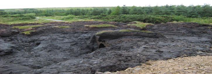
Landslide events are the movement of a mass of rock, earth or debris down a slope. This can be caused by natural (e.g. earthquakes, heavy rainfall) and human factors (e.g. inappropriate earthworks). While Ireland does not have a documented landslide hazard such events do occur occasionally, with a number of high profile landslides in peatlands, Pollatomish, Co Mayo 2003 and Lyrecrompane, Tralee, Co. Kerry 2008. The Geological Survey of Ireland has recently established the Landslide Working Group which among other tasks will establish a database of landslides in Ireland.
Landslides in Ireland are generally split into landslides that occur in peatland and mineral soils. Shallow landslides are likely to be more a concern in mineral soils in Ireland with its low levels of tillage and high levels of grassland land cover. The current GEOtop model has added the simulation component of shallow landslides and channelized debris flow integral with an infinite-slope geotechnical model. The combined model allows both the hydraulic and geotechnical properties of soil to be considered and realistically modelled. In particular, the model has been conceived to make direct use of field surveys, geotechnical characteristics and soil moisture measurements.
Landslides in peat are generally confined to blanket peats. While GEOtop has the ability to simulate landslides, it is confined to mineral soils. It is planned to develop a new GEOtop module for investigating landslides in peat areas.

Sampling
People/Funding
SoilH People
- Prof. Gerard Kiely, UCC, Principal Investigator
- Dr. Chaosheng Zhang, NUIG, Academic Supervisor
- Prof. John Albertson, NUIG, Academic Supervisor
- Mr. Ciaran Lewis, UCC, Ph.D. Student
- Dr. Xianli Xu, UCC, Postdoctoral Research Assistant
- Dr. Paul Leahy, UCC, Postdoctoral Research Assistant
- Mr. Yaxin He, NUIG, Ph.D. Student
- Mr. Joseph Despujols, Ecole Polytechnique, Visiting Student (Summer 2008)
SoilH Funding
Interactions of soil hydrology, land use and climate change and their impact on soil quality (SoilH)—a joint project of UCC and NUIG—is funded by the Environmental Protection Agency under the STRIVE research programme.
Links/Presentations
Links
- GSI (Ireland)
- Environmental Protection Agency (Ireland)
- Online soil erosion assessment tool
- Water framework directive (Ireland)
- SoilC – Monitoring and Modelling of Soil Carbon Stocks
Presentations
Ciaran Lewis, Xianli Xu, John Albertson, Gerard Kiely. The Application of GEOtop for catchment scale hydrology in Ireland., European Geosciences Union (EGU), Vienna, April 2009
Hydrology, Micrometeorology & Climate Investigation Centre
Contact us
Dept of civil and environmental engineering and environmental research institute
